Descriptions
Trek Overview
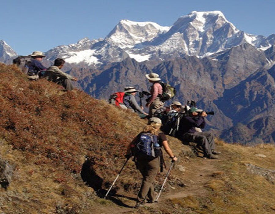
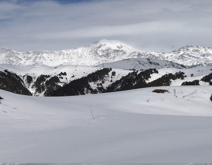
The Nag Tibba Trek is one of the most popular weekend treks in Uttarakhand and the highest peak in the Lesser Himalayas of the Garhwal region. Standing at an altitude of 3,022 meters (9,915 feet), Nag Tibba offers breathtaking views of major Himalayan peaks including Bandarpoonch, Swargarohini, Kedarnath, Gangotri, and Chaukhamba.
Located near Mussoorie, this beginner-friendly trek is perfect for adventure seekers, families, corporate groups, and first-time trekkers looking for a short Himalayan escape from Dehradun.
Trek Highlights
- Summit the highest peak in the Nag Tibba range (3,022 m).
- Ideal weekend trek from Dehradun and Delhi.
- Spectacular views of Bandarpoonch, Swargarohini, Kedarnath, and Chaukhamba peaks.
- Beautiful forest trails through oak and rhododendron forests.
- Overnight camping amidst scenic Himalayan landscapes.
- Perfect trek for beginners and families.
- Stunning sunrise views from Nag Tibba Summit.
- Short and rewarding Himalayan trekking experience.
Program
Day 01: Dehradun – Pantwari – Nag Tibba Base Camp
Arrive in Dehradun and drive to Pantwari Village, the starting point of the trek. The scenic drive passes through picturesque mountain roads and traditional Garhwali villages.
Upon reaching Pantwari, begin the trek towards Nag Tibba Base Camp. The trail gradually ascends through dense oak and rhododendron forests, open meadows, and beautiful mountain landscapes. Enjoy panoramic views of surrounding valleys along the way.
Reach the campsite by evening and relax amidst the serene Himalayan surroundings. Enjoy dinner and an overnight stay in camps.
Drive Distance: Approx. 90 km (4–5 Hours)
Trek Distance: Approx. 4–5 km
Overnight: Camps at Nag Tibba Base Camp
Day 02: Nag Tibba Summit – Base Camp – Pantwari – Dehradun
Wake up early and begin the trek towards Nag Tibba Summit. As you ascend, witness spectacular sunrise views over the snow-capped Himalayas. Upon reaching the summit, enjoy breathtaking panoramic views of Bandarpoonch, Swargarohini, Kedarnath Peak, Gangotri Group, Chaukhamba, and other prominent Himalayan ranges.
After spending time at the summit, descend back to the campsite for breakfast. Continue trekking down to Pantwari Village and drive back to Dehradun.
Arrive in Dehradun by evening, marking the end of a memorable Himalayan adventure.
Trek Distance: Approx. 10 km
Drive Distance: Approx. 90 km (4–5 Hours)
FAQs – Nag Tibba Trek
What is the altitude of Nag Tibba?
Nag Tibba stands at an altitude of approximately 3,022 meters (9,915 feet).
Is Nag Tibba Trek suitable for beginners?
Yes, Nag Tibba is considered one of the best beginner-friendly treks in Uttarakhand.
What is the best time to do the Nag Tibba Trek?
The trek can be done throughout the year. October to April is especially popular for snow trekking, while March to June offers pleasant weather and clear mountain views.
How difficult is the Nag Tibba Trek?
The trek is graded as easy to moderate and is suitable for beginners with basic fitness levels.
What mountain peaks are visible from Nag Tibba Summit?
You can enjoy views of Bandarpoonch, Swargarohini, Kedarnath, Gangotri Peaks, Chaukhamba, and other Himalayan ranges.
How far is Nag Tibba from Dehradun?
Pantwari Village, the trek starting point, is approximately 90 km from Dehradun.
Is camping included in the Nag Tibba Trek package?
Yes, overnight camping at Nag Tibba Base Camp is included in most trek packages.
Why is Nag Tibba Trek famous?
Nag Tibba is famous for its easy accessibility, stunning Himalayan views, beautiful forests, and being one of the best weekend treks near Dehradun and Delhi.
What should I carry for the Nag Tibba Trek?
Carry trekking shoes, warm clothing, a rain jacket, sunglasses, sunscreen, a water bottle, and personal medications.
Can families and children join the Nag Tibba Trek?
Yes, the trek is suitable for families, children, and first-time trekkers with good physical fitness.
Price & Inclusions
5900/- INR
Inclusion Details
Prices Include:
- Accommodation on Twin/Double share basis in hotel (to be advised)
- All meals from day two breakfast to day four breakfast
- All Transportation by tourist vehicle Dehradun to Dehradun
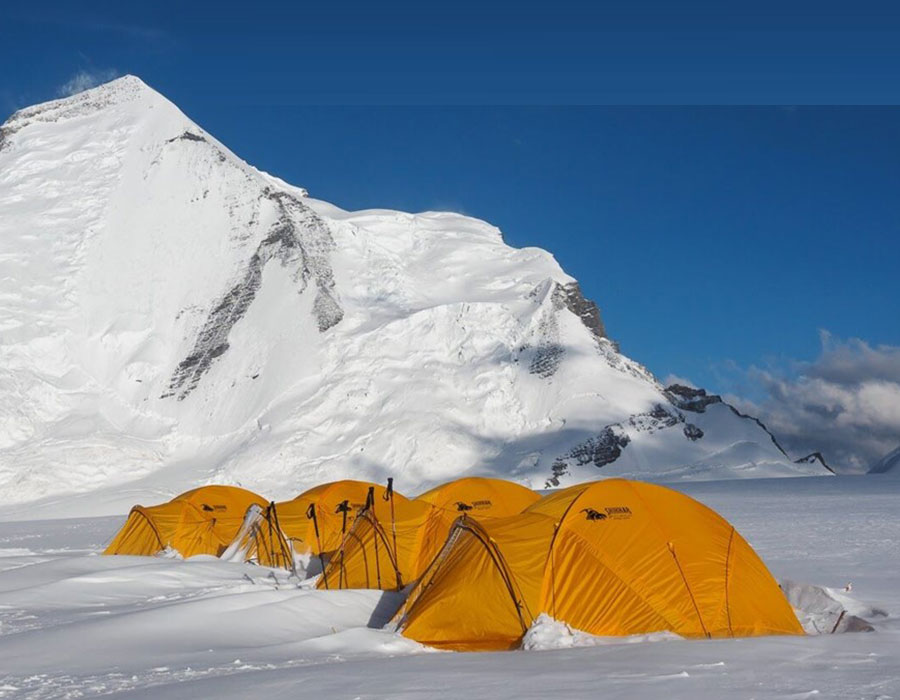
- Tented accommodation and complete camping and kitchen equipment while on trek, including sleeping bags and mattresses for guests.
- Services of tour escort thought the tour Delhi to Delhi
- Services of Mountain Guide. Cooks, helpers and support staff during the trek
- Train fare (by AC chair car Delhi to Dehardun and 3 AC Dehradun to Delhi)
- Camping fees are charged by the respective states or regions.
- Bonfire and stargazing
- Services of Ponies/Porter during trekking from Pantwari to Nagtibba base and back.
- All currently applicable taxes
- First-aid Kit
Exclusion
Prices Do Not Include:
- Items of personal nature like drinks, laundry, telephone calls, tips, camera fees, etc.
- Any Airfare
- Early check-in or a late checkout room (s) at any hotel (s) unless specified above
- Liability for change in itinerary due to reasons beyond our control, like change in flight and train schedule
- Any other item not specifically mentioned above as 'INCLUDED'
General Conditions:
- All prices are subject to any revision to the tax and tariff structure
- Above price is valid till 30 Nov 2020.
- The prices are on a person basis, net and non-commissionable.
- Upon confirmation of the booking, we would require 50% of the total invoice, and the balance amount can be paid 30 days prior to the date of arrival.
- We reserve the right to cancel the tour in the absence of a deposit, balance, or final payment.
Cancellation Policy
Cancellation Charges: Notice of cancellation must be made in writing in the name of Shikhar Travels (India) Pvt Ltd.
For cancellations made 60 days prior to the start of the tour, there will be a cancellation fee of 25% of the invoice. For cancellations made within 60 to 30 days of the start of the tour, there will be a cancellation charge of 50% of the invoice. For cancellations made within 30 days of the start of the tour, there will be a cancellation charge of 100% of the invoice.
In certain cases, the cancellation policy (including conditions applicable to the advance deposit made or required for holding the reservation) may differ and would be applicable as per the cancellation policy of that hotel or service provider. This will be charged in addition to the cancellation policy.
Enquire Now
Photo Gallery


Our Group Sites