Descriptions
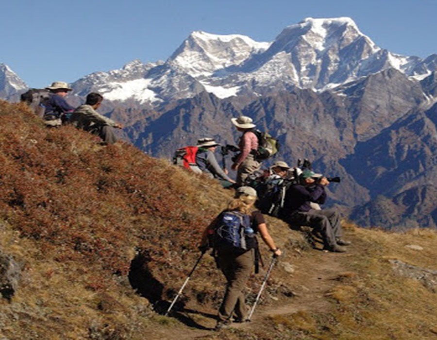
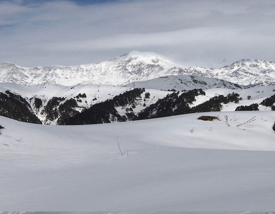
The Rupin pass trek is a scenic rollercoaster that takes you on an urban adventure across the Himalayan range. Walk alongside the Rupin River on traditional shepherd routes, plunging into deep pine forest trails! That's not all, though. There are glacier meadows, snow bridges, glacial valleys, snowfields, and hundreds of waterfalls along the walk!
From easy walks to steep climbing, the Rupin Pass Trail is moderately difficult. Thus, keep the thrill and excitement throughout the Rupin Pass Trek distance. It's an ideal trek for everyone and will pass through every type of terrain. The Rupin pass map start your trek from the greener and comparatively hotter landscapes and move towards the coldest areas over snow.
The trek begins with your arrival in Dehradun, India. From there, you will be traveling to the starting point of your trek- Dhaula, a quaint village located in the Uttarkashi district of Uttarakhand at an altitude of 1,580m.
Constant Scenery Change throughout the Rupin Pass Trek Height
There are plenty of natural surprises, ready to uncover on the way to Rupin pass trek height. The hike crosses through rhododendron fields, and even cherishes walk over narrow zig-zag paths around the cliffs. With Rupin River as your constant companion, the trail ascends steeply through lush pine forests. Eventually, opening up to spectacular views of the Jhaka village. The portion of the village is startlingly set on a steep slope. Thus, making it look like it's hanging from the cliff earning it its name “the hanging village”.
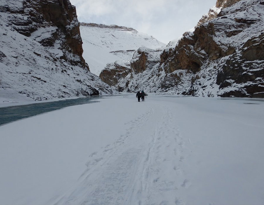
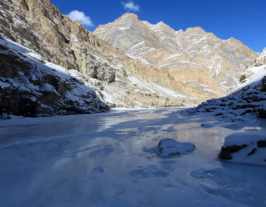
Enjoy taking rest by the stunning snow bridge over the Rupin River. Meanwhile, soak in the contrastingly beautiful view. A short while going down the narrow shepherd's path, the hiking path opens up to a beautiful grassland called Udaknal.
Also, do not forget to cherish your stay with the locals. Of all the amazing things in this trek, homestays has a separate fan-base and is often considered as Rupin pass trek best time. With Himalayan Holidays, enjoy spending your first night at a homestay.It's the best way to experience local lifestyles, savoring some delicious home-cooked meals.
Unmatched Series of Ethereal Vistas all along the Rupin Pass Trek Route
You should get used to surprises, halfway on the Rupin Pass Trek Route. As they are a constant thing as you trail towards Rupin pass height. One such surprise is the three-staged Rupin waterfall, situated in 'The Land of 1000 Waterfalls' Dhanderas. We bet, it’ll leave you awestruck and amazed with its spectacular beauty.
Observing the waterfall disappear into the valley is a sight to behold. It makes you feel like the luckiest person out there to witness such artwork of nature. You can take photos at this most picturesque and cinematic location one can imagine.
In addition to this, enjoy the blissful sight of saddle-shaped Rupin Pass cutting its way through the Dhauladhar Ranges. Later, as you continue hiking you can notice the landscape changes beautifully. Just like we promised in our Rupin Pass Trek Package. Once done, get ready for a sharp and rapid descent over a snowline.
Rupin Pass Trek is entitled the Grand Himalayan Adventure that’s Must-Visit
The difficulty of this trek itinerary is ideal for adventure seekers and experienced hikers. The next phase of Rupin trekking map is to reach the Ronti Gad campsite via Rupin Pass. The climb on Rupin pass trek map is steep and quite tiring. Moreover, the elevation distance is full of knee-deep snow and has some slippery sections too. However, the effort seems worthy as you achieve Rupin Pass altitude.
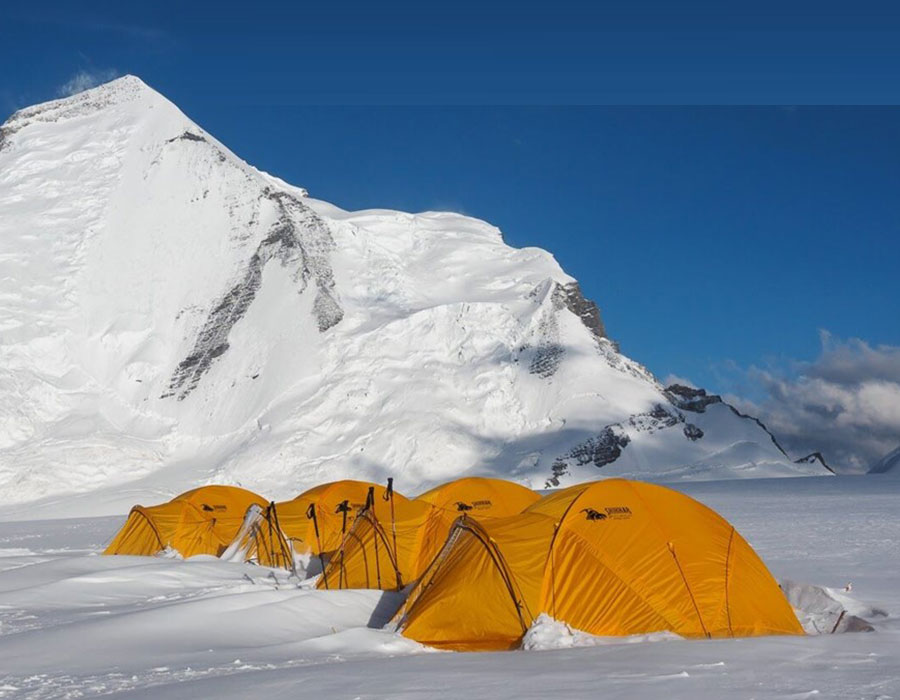
Get a chance to walk on the snowline. Later, be prepared for another sharp descent that leads you to the Ronti Gad Campsite. Camp overnight in the vicinity of the towering snow-capped mountains, on an endless meadow with a stream flowing gently through the mountains.
Near the end of your trek, you will witness the Kinner Kailash Mountain in its complete magnificence. Standing tall at the height of 19,849 feet, the peak is considered sacred by both Hindu and Kinnauri Buddhists.
The trek concludes with the first signs of civilization afar in the tiny village of Sangla Kanda. Take a quick sip of tea, relax and admire the beauty of this village and its tiny old stone houses and prepare yourself to bid goodbye to this journey through the wonderland.
Rupin Pass Trek Altitude Profile
-
Dhaula (Trek Start) — 5,184 ft / 1,580 m
-
Sewa — 6,890 ft / 2,100 m
-
Jakha Village — 8,530 ft / 2,600 m
-
Burash Kandi — 9,514 ft / 2,900 m
-
Dhanderas Thatch — 11,155 ft / 3,400 m
-
Upper Waterfall Camp — 12,139 ft / 3,700 m
-
Rupin Pass (Summit) — 15,250 ft / 4,650 m
-
Ronti Gad (Descent) — 12,467 ft / 3,800 m
-
Sangla (Trek End) — 9,186 ft / 2,800 m
Weather on Rupin Pass Trek
Month | Day Temp (at campsite) | Night Temp (at campsite) | Pass Conditions May | 10–18°C | -3 to 2°C | Deep snow; microspikes mandatory June | 12–20°C | 0 to 5°C | Snow reducing; good conditions September | 8–16°C | -2 to 4°C | Clear skies; some snow at pass October | 4–12°C | -8 to -2°C | Cold nights; beautiful colours
Program
Day 1: Dehradun to Dhaula
Stay - Homestay / Guesthouse
Meal - Dinner
Drive - 180 km
- Arrive in Dehradun and drive to Dhaula.
- Enjoy your ride through crossing Kempty Falls, deep gorges, misty pine forest, with gushing Yamuna and Rupin rivers on the side.
- Reach Dhaula by evening to have dinner and later retire for the day.
Day 2: Dhaula to Sewa
Stay - Camps
Meal - Breakfast + Lunch + Dinner
Trek - 12 km
- Post breakfast, start your trek to Sewa.
- Hike on a dusty trail with gradual ascents and descents.
- Journey through the pink trail of rhododendron forest alongside the Rupin River.
- Once arrived, rest and acclimatize in your homestay.
Day 3: Sewa to Jakha Village
Stay - Camps
Meal - Breakfast + Lunch + Dinner
Trek - 14 km
- Wake up early for a brief session of Yoga and stretching.
- Afterwards, begin trekking on a moderately steep trail followed by a descent to Rupin Riverbed.
- Crossover from Uttarakhand to Himachal Pradesh on a wooden bridge over the Rupin River.
- Stay in a homestay for the night.
Day 4: Trek from Jakha to Burash Kandi
Stay - Camps
Meal - Breakfast + Lunch + Dinner
Trek - 9 km
- Start hiking on a fairly narrow and zigzag path, alongside a cliff.
- Take a steep ascent, getting a glimpse of The Hanging Village- Jakha.
- Enjoy changing vistas at every turn, from narrow & rocky paths to magnificent fir forest.
- Cross the snow bridge to reach the beautiful grassland called Udaknal.
- Reach the campsite set in the backdrop of Rhododendron and colossal mountain views.
Day 5: Trek from Burash Kandi to Dhanderas Thatch
Stay - Camps
Meal - Breakfast + Lunch + Dinner
Trek - 5 km
- Start your hike through the mixed forest of Oak, Fir, and Rhododendrons.
- After a steep incline get the most gripping sights of the U-shaped valley nestling the majestic Rupin waterfall afar.
- Continue trekking through the patches of sacred Bhoj trees, finally reaching the expansive green meadows of Dhanderas Thatch.
- Camp at Dhanderas Thatch- also known as the “Land of a Thousand Waterfalls”.
Day 6: Trek from Dhanderas Thatch (Lower Waterfall) to Upper Waterfall Campsite
Stay - Camps
Meal - Breakfast + Lunch + Dinner
Trek - 4 km
- Have your delicious breakfast, making a short hike to the top of the Rupin Waterfall.
- Trek on the snow till you reach the meadows at the top.
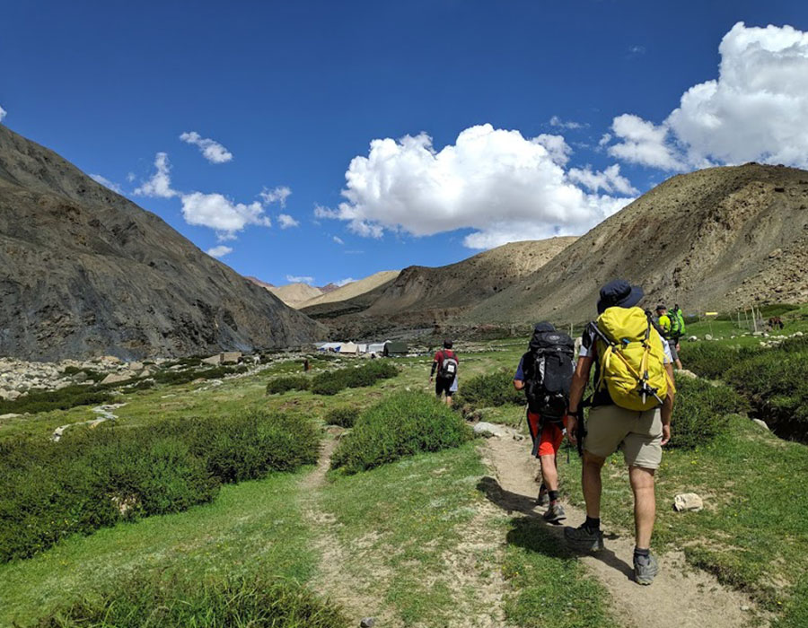
- Once arrived, rest in your campsite located in the gorgeous meadow on the banks of a gently flowing stream.
Day 7: Trek from Upper Waterfall to Ronti Gad via Rupin Pass (4650m)
Stay - Camps
Meal - Breakfast + Lunch + Dinner
Trek - 8 km
- Start early around 5 AM for a steep ascent to Rati Pheri. Hike with your packed breakfast & lunch, since it's the longest and the most thrilling day of the trek.
- The expansive views of the Rupin valley are replaced by the alpine Dhauladhar range as you now move ahead over vast snowfields.
- After a long and steep icy climb, get the blissful sight of saddle-shaped Rupin Pass cutting its way through the Dhauladhar Ranges.
- Spend enough time at the Rupin Pass. Afterward, trek down to the Ronti Gad campsite.
- Enjoy camping in the vicinity of the towering snow-capped mountains around.
Day 8: Ronti Gad to Sangla and then Shimla drop
Meal - Breakfast
Trek - 8 km
Drive - 225 km
- Trek on a dusty trail crossing the traffic of cattle.
- Get the first glimpses of the snow-clad Kinner Kailash range.
- Take a quick break in the Sangla Kanda village.
- The trek gradient rapidly declines, crossing terraced farms, apple orchards, and old stone houses.
- Reach Sangla, followed by a drive to Shimla.
Best Time for Rupin Pass Trek
Recommended Window: May to June and September to October
May: Heavy snow coverage near and above the pass. The Rupin Waterfall is at its most spectacular — full, thundering, and dramatic. Microspikes are essential. Best for snow enthusiasts.
June: Snow reduces on lower trails. Rhododendrons in bloom along the approach. Most popular month. Good conditions throughout.
July–August (Monsoon): Avoid for first-timers. Lower forest sections become muddy and leech-prone. Risk of slippery trail conditions and occasional road disruptions on the Dehradun–Dhaula approach.
September: Post-monsoon clarity. Trails are dry and well-defined. Views are excellent. Light snow on the pass. One of the best months overall.
October: Beautiful autumn colours in the rhododendron forests. Nights get very cold (below -5°C at pass altitude). Snow increases toward month end — plan for the first three weeks.
Most trekkers who have done Rupin Pass recommend late May to early June for the snow spectacle and September for the clearest skies.
How to Reach Rupin Pass Trek
- By Air:- Jolly Grant Airport in Dehradun is 25km. away from the city.
- By Train:- If you are planning to go from train best option is to catch an overnight train from Delhi to Dehradun.
- By Road:- There are plenty of bus services available from Delhi to Dehradun.
Things to Carry for Rupin Pass Trek Package
- Shirts/T-shirts –2/3, Jeans/Trekking Pants -2
- Windproof jacket of decent quality (no flimsy wind cheaters please!) preferably with a hood
- Warm and thick Fleece/Full-sleeve Woollen sweater
- Thermal inner wear (upper & lower), Scarf/muffler (optional)
- Woollen cap, Woollen gloves, Woollen socks & regular socks (3-4 pairs)
- Comfortable Trekking/Hiking shoes (Waterproof shoes with a thick sole are recommended)
- Lightweight floaters/sandals/slippers
- Raincoat/Poncho, Small quick dry towel
- Water bottle (sturdy ones, no empty plastic bottels bottles!!)
- Cap/Hat to keep the strong sun away from your face
- Sun glasses (polarized/UV Protected), Walking stick/Trekking pole
- Sunscreen Lotion, Lip Balm, Torch/Flashlight (with extra batteries)
- Medicines, if requiring any specific medication
Personal toiletries - Day pack/small bag in case if you are planning to offload your regular backpack
- Hand Sanitizer
- Extra face masks
- Camera if you like (with fully charged batteries)
Permits for Rupin Pass Trek 2026
- Forest and Camping Permit — Included in the Himalayan Holidays package fee.
- No Inner Line Permit required for Indian nationals on this route.
- Valid Government Photo ID (Aadhaar / Passport) is mandatory throughout the trek. Carry at least one photocopy.
- Foreign nationals must carry valid passport copies. Additional permits may apply — confirm at time of booking.
Safety Tips for Rupin Pass Trek
- Summit Day (Day 7) starts at 5 AM. Do not underestimate it — it is the longest and most physical day of the trek. Stay with the group and follow the trek leader's instructions throughout.
- Microspikes are essential on the pass crossing, especially in May–June. These are included in the package — confirm at booking.
- Snow bridges (Day 4): Cross carefully and one at a time. These are natural snow bridges over the Rupin River — stable but require caution.
- Leeches on lower trails (July–August): Apply insect repellent and tuck socks over trouser bottoms. Salt is an effective deterrent if needed.
- Weather on the pass changes quickly. If the trek leader calls off or delays the summit attempt, that decision is final and non-negotiable. Safety always comes first.
- No ATMs beyond Uttarkashi. Carry sufficient cash from Dehradun for the entire trek.
Price & Inclusions
On Request
Inclusion Details
- You will be greeted by our team on your arrival to Dhaula campsite.
- All stays included from Dhaula to Ronti Gad on a sharing basis:
(i) Guest House on Day 1.
(ii) Dome tents from day 2 - 7. - All meals included from Day 1 dinner to Day 8 breakfast. Vegetarian meals will be served throughout the trek.
- Skilled local staff who have ample knowledge of the route
Kitchen, dining and toilet tents will be used during the trek. - Cooks/Helper for carrying common equipment like rations/tents/utensils/groceries.
- All trek essentials included –
(i) Accommodation - tents, sleeping bags, sleeping mats, etc
(ii) Safety equipment - microspikes as per requirements and basic first aid kit with a portable oxygen cylinder.
(iii) Permit - forest and camping fee included.
Exclusion
- Transportation on Day 8, from Sangla to Shimla is not included.
- The above trek charges do not include the GST charges (5%).
- In case if your trek remains incomplete or uninitiated because of "force majeure", a medical emergency, or by personal choice after you arrive at the starting point, you will not be able to get a refund, reschedule or replace any services that remain unutilized by you.
- Any additional cost incurred due to changes in Government
- Anything which is not included in Inclusion.
FAQ's
Q1. What is the Rupin Pass Trek?
The Rupin Pass Trek is an 8-day moderate-to-difficult Himalayan trek that crosses the Rupin Pass at 15,250 ft (4,650 m), connecting Dhaula village in Uttarkashi (Uttarakhand) with Sangla in Kinnaur (Himachal Pradesh). The trek is famous for the iconic three-tiered Rupin Waterfall, the Jakha "hanging village," dramatic snow bridges, and sweeping views of the Dhauladhar and Kinnaur ranges.
Q2. What is the altitude of Rupin Pass?
Rupin Pass is at 15,250 ft (4,650 m) above sea level. This is the highest point of the trek, crossed on Day 7. The Upper Waterfall base camp the night before sits at approximately 12,139 ft (3,700 m).
Q3. How difficult is the Rupin Pass Trek?
The trek is rated Moderate to Difficult. Daily walks range from 4 to 14 km. Day 7 — the summit day — is the most demanding, involving a steep pre-dawn ascent over snowfields starting at 5 AM. No technical mountaineering experience is needed, but good fitness and basic trekking experience are strongly recommended.
Q4. What is the best time for the Rupin Pass Trek?
May to June and September to October are the best windows. May–June offers spectacular waterfall views and deep snow near the pass. September–October has clearer skies and drier trails. Avoid July–August (monsoon, leeches) and December–March (pass inaccessible under heavy snow).
Q5. Does the Rupin Pass Trek cross into Himachal Pradesh?
Yes. The trek starts in Dhaula, Uttarkashi (Uttarakhand) and crosses into Himachal Pradesh at Jakha Village on Day 3 via a wooden bridge over the Rupin River. The trek ends at Sangla, Kinnaur district (Himachal Pradesh).
Q6. What is the Jakha hanging village?
Jakha is a village perched on a steep cliff slope, appearing to "hang" from the mountainside. It is one of the most visually striking sights on the trek, encountered on Day 3. The wooden bridge near Jakha also marks the Uttarakhand–Himachal Pradesh state border.
Q7. What is the Rupin Waterfall?
The Rupin Waterfall is a three-tiered cascade set in a dramatic U-shaped valley known as "The Land of a Thousand Waterfalls" (Dhanderas Thatch). It is the scenic centrepiece of the trek, encountered on Days 5–6. In May–June, the waterfall runs at full force and is a genuinely spectacular sight.
Q8. Are permits required for the Rupin Pass Trek?
Forest and camping permits are required and are included in the Himalayan Holidays package fee. No Inner Line Permit is required for Indian nationals. Carry valid government photo ID throughout the trek.
Q9. What is included in the Rupin Pass Trek package?
The package includes: guesthouse stay on Day 1, dome tent camping from Days 2–7, all meals from Day 1 dinner to Day 8 breakfast, local skilled staff, trek leader, kitchen / dining / toilet tents, microspikes (as needed), basic first aid with portable oxygen cylinder, and all forest and camping permits.
Q10. Is transport from Sangla to Shimla included?
No. Transport from Sangla to Shimla on Day 8 (approximately 225 km) is NOT included in the package and must be arranged independently. Shared cabs and bus services are available from Sangla.
Q11. How do I reach Dhaula, the trek starting point?
Dhaula is approximately 180 km from Dehradun via Vikasnagar, Purola, and Mori (5–6 hours). Himalayan Holidays arranges group transport from Dehradun to Dhaula on Day 1. The nearest airport is Jolly Grant, Dehradun; the nearest railway station is Dehradun.
Q12. Is the Rupin Pass Trek suitable for first-timers?
It is manageable for fit first-timers who prepare well (6–8 weeks of regular cardio including hill walking). However, Day 7 (summit day) is genuinely demanding. If this is your first Himalayan trek, inform our team so we can provide appropriate pacing guidance throughout.
Enquire Now
Photo Gallery


Our Group Sites